- Home
- »
- Agencies & Departments
- »
- Engineer
- »
- Map Department
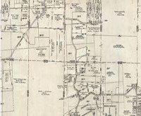
Map Department
The Map Department supports the County Engineer’s mapping and surveying responsibilities. Our staff maintains the official county tax maps and reviews all surveys and legal descriptions for property transfers in Licking County to ensure compliance with legal standards.
Please submit all legal descriptions and surveys to [email protected] for pre-approval and review.
We also provide detailed mapping information to the public. Customers may request specific maps or mapping data for any area within the county.
Available Maps & Fees
Property Tax Maps (Black & White)
-
8½" × 11" — $0.50
-
11" × 17" — $1.00
-
24" × 36" — $3.00
Aerial Photos (Color)
-
8½" × 11" — $0.50
-
11" × 17" — $1.00
-
22" × 34" (D Size) — $6.00
-
34" × 44" (E Size) — $10.00